Lu Liang, who uses data to analyze environmental change, joins LAEP faculty
Geospatial scientist Lu Liang joined CED in January as associate professor in the Department of Landscape Architecture & Environmental Planning. She is a specialist in using GIS and remote sensing to map and analyze the landscape. Liang has an extensive background in analyzing environmental changes at the regional and global scales. In her new role at CED, she plans to take a human-centered approach, exploring how the physical environment affects each of us in our daily lives.
It’s a homecoming for Liang, who received her doctorate from Berkeley’s Department of Environmental Science Policy and Management in the College of Natural Resources. “I am so happy to be back in Berkeley and be part of its community of cutting-edge cross-disciplinary researchers. I really enjoy working collaboratively and there is so much freedom here for hybrid research,” Liang says.
She is especially eager to connect with researchers in other CED departments and across campus who are tracking the effects of our changing climate in order to alleviate the often inequitable community impacts of environmental hazards.
“We are thrilled to welcome Lu to the department,” says Walter Hood, chair of Landscape Architecture & Environmental Planning. “She is a fantastic addition to our faculty and we are lucky to have her here.”
Tracking environmental patterns:
from global scale to city block
As an undergraduate, Liang studied geography at Beijing Normal University. The discipline’s combination of STEM fields with the study of the natural landscape appealed to her. “I liked that it combined the indoors and the outdoors; you could spend time in nature and then go back in front of your computer to analyze the data you gathered, which is rewarding and meaningful,” she says.
GIS (Graphic Information System) was a relatively new tool then. She was struck by its ability to visualize data to reveal patterns. It’s these patterns that prompt us to ask, “why?” — and generate research questions.
As a graduate student, Liang asked questions of data sets captured on a broad scale. For her MS in cartography and geographic information science, she tracked patterns of avian flu across the globe. For her PhD, she turned to the regional scale, mapping beetle infestations in the Rocky Mountains.
In her current research, which she began while on the faculty of the University of North Texas (UNT), Liang is interested in asking how environmental conditions, such as air pollution, impact the daily lives of individuals in cities. “I wanted to zero in on a finer-grained scale and apply my research to us. How does air pollution affect me and people I know in my community?”
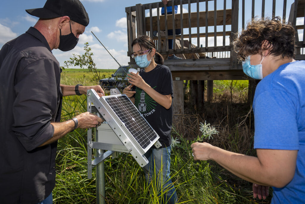
Her 3M lab (Monitoring-Mapping-Modeling) at UNT harnessed citizen science to monitor air pollution in the county surrounding the campus. She recruited volunteers to wear air pollution monitors and GPS trackers to gather data.
This research, published in Environmental Pollution, demonstrated how low-cost sensors can be used in conjunction with GeoAI to track air pollution inequality at the scale of the urban block, generating actionable solutions.
“I wanted to quantify how different urban communities experience distinct environmental situations. Looking at data at the level of the street and the neighborhood can give communities the data they need to advocate for more resources.”
Using data to inform environmental design decisions
At Berkeley, Liang plans to apply GIS, UAV (aka drone), and low-cost sensor techniques to investigate flooding and drought, urban heat, and other climate change–driven extreme weather events. First-hand data is essential to inform design and planning decisions, she believes.
“Designers of cities, landscapes, and buildings need to have a data mindset,” she says. “Science can help them understand their sites and the impact of any design decisions.”
She notes that architects could use drones to quickly generate accurate 3D rendered topographical site plans, while landscape architects could use data to anticipate the environmental implications of the placement of trees and other landscape elements.
It’s been just a few weeks since she arrived back at Berkeley, but Liang has already recruited 10 students to work in her data mapping lab through the Undergraduate Research Apprentice Program. One team will focus on tracking air pollution while the other will use UAV to study tree stress under extreme heat. She is looking forward to shifting gears: “In Texas, I spent a lot of time detecting particles and dust.”
View Lu Liang’s faculty profile to learn more and see a list of selected publications.