WORK
Spring 2015 — LA 254: Applied Remote Sensing
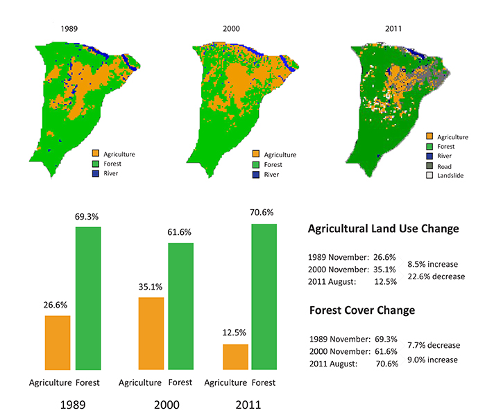
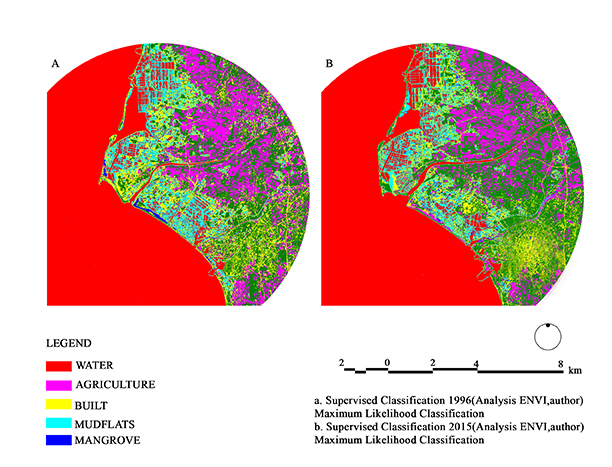
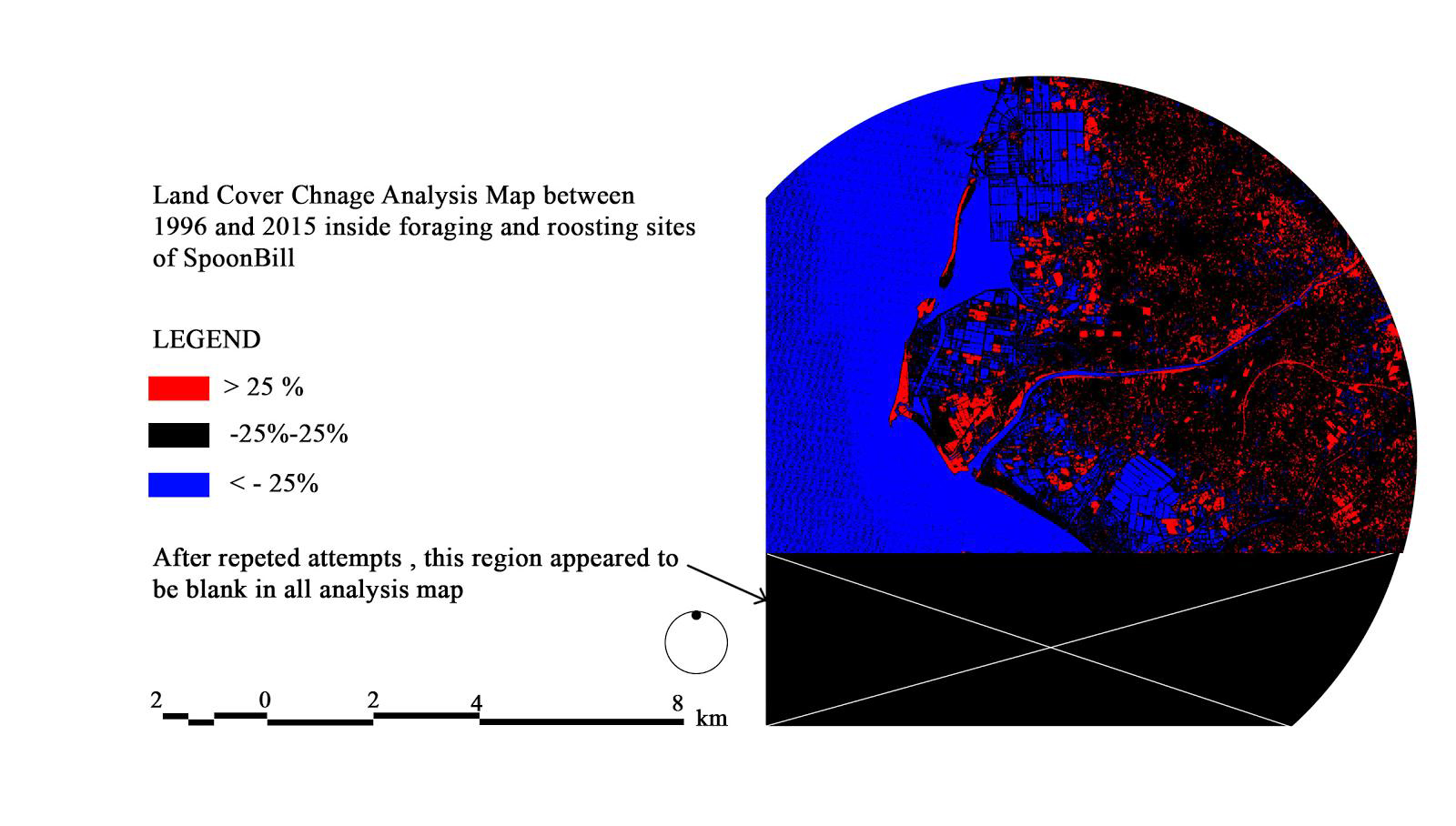
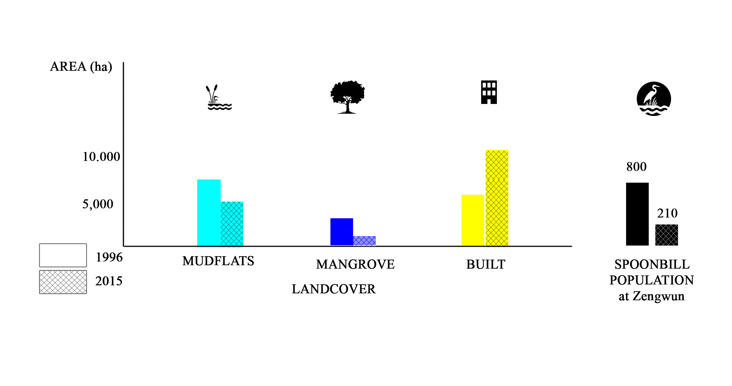
This course introduced fundamental principles and methods of environmental remote sensing and their practical applications. Explorations included different types of remote sensing data (e.g., satellite and aerial images, lidar) and extracting image-based information for specific research and planning objectives. Focused on local to regional scale applications of remote sensing in ecology, environmental planning and design, civil engineering and natural resource management.
