Maryam Hosseini, who uses AI to make cities walkable and accessible, joins Department of City & Regional Planning
With AI, computer vision, and open-source tools, Hosseini’s work advances walkability and accessibility in cities.
How does the design of the built environment influence how people use and experience cities?
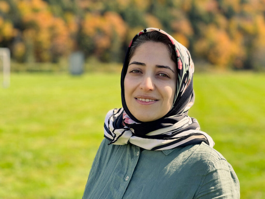
This question lies at the heart of Maryam Hosseini’s work. Hosseini, who earned her PhD in urban systems from Rutgers University and conducted her dissertation research at VIDA Lab in NYU’s Computer Science Department, joins the Department of City & Regional Planning this semester as assistant professor. Since 2022, she has been a postdoctoral researcher in MIT’s Department of Urban Studies and Planning, blending her expertise in urban systems, computer vision, and economics to advance urban planning methods.
Hosseini’s research centers on improving the walkability, accessibility, and equity of cities through cutting-edge machine learning techniques and open-source tools. These innovations empower planners, policymakers, and researchers to design urban environments that are inclusive, resilient, and reflective of diverse needs. From enhancing disability access to analyzing pedestrians’ exposure to extreme heat and flood risks, Hosseini’s work addresses complex challenges at the intersection of technology, environment, and urban design.
Sidewalks for equitable, accessible urban design
Hosseini’s early experiences growing up in Tehran sparked her interest in walkable cities. There, she explains, streets and plazas were vibrant, bustling spaces where people connected and moved freely.
When she moved to suburban New Jersey for her doctoral studies, she encountered a striking contrast. “Living in a town without sidewalks was a sharp reminder of how the built environment can exclude people,” she says. “It wasn’t just about my own mobility—it made me think deeply about how these spaces affect people with disabilities, older adults, and other nondrivers who rely on pedestrian infrastructure.”
These experiences fueled her commitment to studying sidewalks—not merely as functional pathways but as essential components of equitable urban design.
Developing computer vision tools to analyze pedestrian infrastructure: Tile2Net and CitySurfaces
As she set out to study pedestrian mobility and accessibility, Hosseini identified a significant gap. “Although we have abundant data on nearly every aspect of vehicular travel, we have comparatively little information on active modes like walking and biking,” she says.
This lack of data makes it difficult to implement research on pedestrian infrastructure and holds back the technology industry from developing accurate, location-based apps for pedestrians, wheelchair users, street vendors, and other sidewalk users. “Data availability drives where decisions are focused. And it became my mission to help bridge this data gap.”
During her doctoral work at NYU’s VIDA Lab, Hosseini developed Tile2Net, an open-source tool that creates detailed pedestrian network maps using semantic segmentation to detect roads, sidewalks, crosswalks, and footpaths from aerial imagery. Developed in collaboration with researchers at MIT, University of Illinois Chicago, and the University of São Paulo in Brazil, Tile2Net was used to map pedestrian networks in major U.S. cities like New York; Washington, D.C.; and Boston.
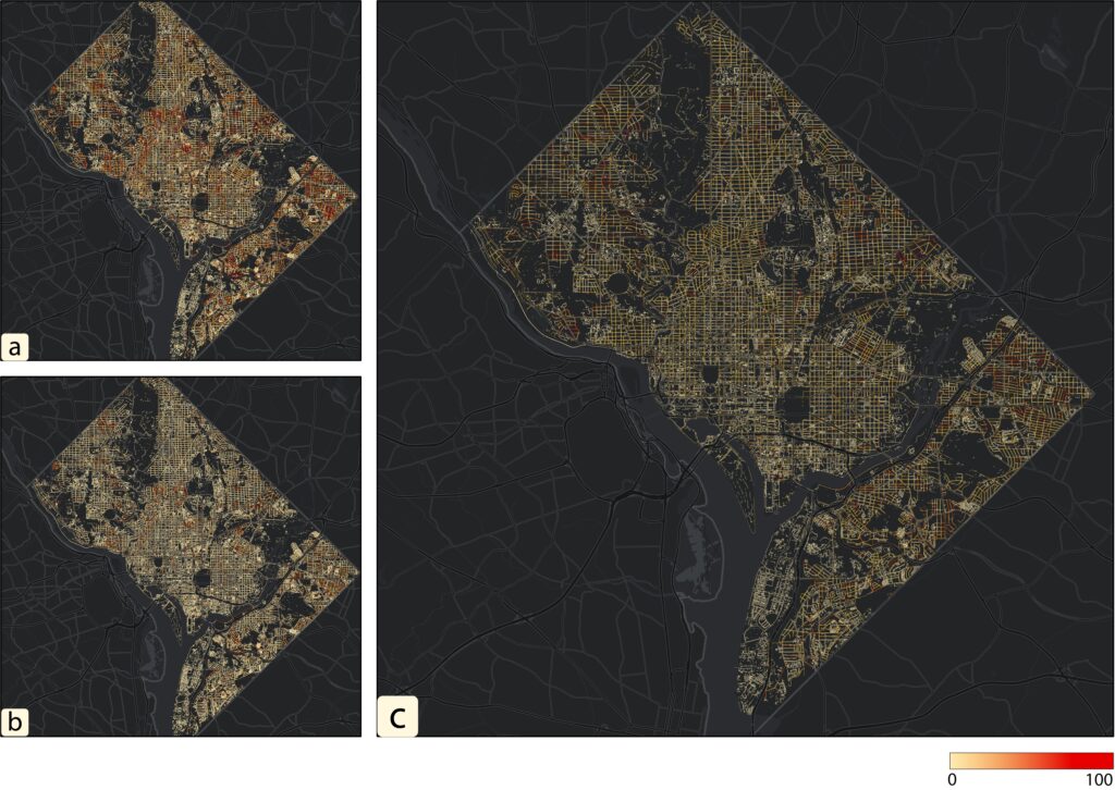
Tile2Net has been used by researchers at the Centers for Disease Control and Prevention Physical Activity and Health Branch and has drawn international attention for its potential to foster more walkable, inclusive environments. An enhanced version of the tool, featuring advanced visualization and topology improvements, is slated for release this spring.
Beyond pedestrian networks, Hosseini’s dissertation introduced CitySurfaces, another open-source tool that employs computer vision to analyze sidewalk materials—an important yet overlooked factor in mobility and climate resilience. Used alongside accumulated shadow data, another project from NYU’s VIDA Lab, CitySurfaces helped create a detailed map of sidewalk composition in New York City. An occupational therapist at NYU later used these data to locate areas most prone to black ice formation under severe weather conditions and sudden temperature drops, where impervious surfaces and persistent shade increase fall risk. These materials have wide-ranging implications for wheelchair users and the elderly. Surface traction impacts the gliding action of wheelchairs, while uneven pavement materials and indistinguishable surface colors can contribute to falls.
Sidewalk materials also play a role in urban microclimates. The absorptive properties of various paving affect urban flooding and sewer overflow, while thermal performance and reflectivity can exacerbate or mitigate heat island effects.
International collaborations extend reach and impact of Hosseini’s research
Hosseini’s research is enriched by interdisciplinary collaborations. With researchers at the University of São Paulo and UIC, she has developed a framework for studying sidewalks, which included creating a multimodal data of sidewalk conditions near hospitals, a smartphone-based tool for collecting synchronized multimedia data, and a Python library for data analysis.
In collaboration with colleagues at Rutgers University and the World Food Organization, Hosseini is working to improve food security and aid targeting in Congo. By using satellite imagery, the team is creating the first detailed maps of roads and building footprints, providing critical insights to optimize humanitarian efforts and enhance social welfare.
One of her recent projects, ELSA (Evaluating Localization of Social Activities in Urban Streets), was developed as part of the Designing for Sustainability MIT-HPI Joint Research Program, in collaboration with the Hasso Plattner Institute in Germany. While open-vocabulary object detection (OVD) models promise the ability to interpret diverse natural language queries, no standardized evaluation framework existed for these systems. ELSA addresses this gap by introducing novel algorithms and metrics to assess OVD performance. These innovations can support the development of models to explain the spatial distribution of social activities, offering new ways to understand how urban spaces facilitate or hinder social interactions.
Focusing on accessibility in the birthplace of the disability movement
Hosseini sees Berkeley, the birthplace of the disability movement, as the perfect fit for her research interests. “Accessibility is so important to me and Berkeley has always been at the forefront of this issue,” she says. She is also looking forward to making connections with computer scientists and public health researchers on campus, as she sees her research as bridging those fields.
At CED this spring, Hosseini will be teaching urban informatics and visualization, training the next generation in computational thinking and coding skills. “The Berkeley students I’ve met, both undergraduate and graduate, are excited to learn and are eager to make change in the world,” she says. “That’s why it was an easy choice to come to Berkeley.”